Solution Manual for McKnight's Physical Geography: A Landscape Appreciation, 12th Edition

Preview Extract
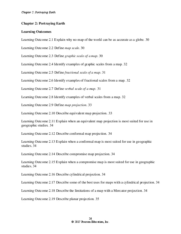
Chapter 2: Portraying Earth Chapter 2: Portraying Earth Learning Outcomes Learning Outcome 2.1 Explain why no map of the world can be as accurate as a globe. 30 Learning Outcome 2.2 Define map scale. 30 Learning Outcome 2.3 Define graphic scale of a map. 30 Learning Outcome 2.4 Identify examples of graphic scales from a map. 32 Learning Outcome 2.5 Define fractional scale of a map. 31 Learning Outcome 2.6 Identify examples of fractional scales from a map. 32 Learning Outcome 2.7 Define verbal scale of a map. 31 Learning Outcome 2.8 Identify examples of verbal scales from a map. 32 Learning Outcome 2.9 Define map projection. 33 Learning Outcome 2.10 Describe equivalent map projection. 33 Learning Outcome 2.11 Explain when an equivalent map projection is most suited for use in geographic studies. 34 Learning Outcome 2.12 Describe conformal map projection. 34 Learning Outcome 2.13 Explain when a conformal map is most suited for use in geographic studies. 34 Learning Outcome 2.14 Describe compromise map projection. 34 Learning Outcome 2.15 Explain when a compromise map is most suited for use in geographic studies. 34 Learning Outcome 2.16 Describe cylindrical projection. 34 Learning Outcome 2.17 Describe some of the best uses for maps with a cylindrical projection. 34 Learning Outcome 2.18 Describe the limitations of a map with a Mercator projection. 34 Learning Outcome 2.19 Describe planar projection. 35 26 ยฉ 2017 Pearson Education, Inc. Chapter 2: Portraying Earth Learning Outcome 2.20 Describe some of the best uses for maps with a planar projection. 35 Learning Outcome 2.21 Describe conic projection. 36 Learning Outcome 2.22 Describe some of the best uses for maps with a conic projection. 36 Learning Outcome 2.23 Describe pseudocylindrical projection. 36 Learning Outcome 2.24 Describe some of the best uses for maps with a pseudocylindrical projection. 36 Learning Outcome 2.25 Identify the basic components of a map. 37 Learning Outcome 2.26 Explain how isolines are used to convey information on a map. 37 Learning Outcome 2.27 Identify two methods of portraying the three-dimensional aspect of the landscape on a map. 39 Learning Outcome 2.28 Define GNSS. 40 Learning Outcome 2.29 Describe how a GPS unit determines its location. 40 Learning Outcome 2.30 Describe some common uses of GPS. 40 Learning Outcome 2.31 Define remote sensing. 41 Learning Outcome 2.32 Discuss the kinds of information that can be gathered by remote sensing. 41 Learning Outcome 2.33 Describe the remote sensing method that most satellites use today. 41 Learning Outcome 2.34 Distinguish passive remote sensing systems from active remote sensing systems. 41 Learning Outcome 2.35 Describe overlay analysis. 48 Learning Outcome 2.36 Explain how GIS helps in the analysis of geographic data. 48 Chapter 2: Portraying Earth Chapter Two provides the reader with an appreciation of the geospatial techniques and technologies used to measure and map the Earthโ€™s surface. Many of these technologies are evolving rapidly as computer advances allow geographers to collect, store, and analyze large quantities of data, making geographic information increasingly accurate and precise. 27 ยฉ 2017 Pearson Education, Inc. Chapter 2: Portraying Earth The purpose of Chapter Two is twofold: โ€ข To describe the basic characteristics of maps, including their capabilities and limitations as tools for geographic study โ€ข To describe the various ways a landscape can be portrayedโ€”through map projections, globes, photographs, and remotely sensed imagery Maps are the most important and universal of the various tools used in geographic studies. Mapping of any geographic feature is normally essential to understanding the spatial distributions and relationships of that feature. TOPICS Maps and Globes Maps Map Distortions Map Scale Scale Types Graphic Map Scales Fractional Map Scales Verbal Map Scales Large-Scale and Small-Scale Maps Map Projections and Properties Map Projections Map Properties Equivalence Conformality Compromise Projections Families of Map Projections Cylindrical Projections Mercator: The Most Famous Projection Planar Projections Conic Projections Pseudocylindrical Projections Interrupted Projections Conveying Information on Maps Map Essentials Title Date Legend Scale Direction Location Data Source Projection Type Isolines Characteristics of Isolines 28 ยฉ 2017 Pearson Education, Inc. Chapter 2: Portraying Earth Drawing Isolines Portraying the Three-Dimensional Landscape Elevation Contours Digital Elevation Models GNSSโ€”Global Navigation Satellite System Wide Area Augmentation System (WAAS) Continuously Operating GPS Reference Stations (CORS) GPS Modernization Program GPS Applications GPS Display of Latitude and Longitude Remote Sensing Aerial Photographs Orthophoto Maps Visible Light and Infrared Sensing Thermal Infrared Sensing Multispectral Remote Sensing Landsat Earth Observing System Satellites Commercial High-Resolution Satellites Radar, Sondar, and Lidar Geographic Information Systems (GIS) Overlay Analysis GIS in Decision Making Tools of the Geographer Choosing Effective Maps and Imagery Global Environmental Change: Growing a City in the Desert Focus: GIS for Geographic Decision Making CHAPTER OUTLINE I. Maps and Globes A. Maps 1. Mapโ€”a two-dimensional representation of the spatial distribution of selected phenomena. 2. Basic attributes of maps make them indispensable: a) Their ability to show distance, direction, size, and shape in horizontal (twodimensional) spatial relationships. b) They depict graphically what is where and they are often helpful in providing clues as to why such a distribution occurs. B. Map Distortions 1. Basic disadvantage of maps: a) No map can be perfectly accurate. 1) Maps are trying to portray the impossibleโ€”taking a curved surface and drawing it on a flat piece of paper. 29 ยฉ 2017 Pearson Education, Inc. Chapter 2: Portraying Earth II. Map Scale A. Map scaleโ€”gives the relationship between length measured on the map and corresponding distance on the ground. Essential for being able to measure distance, determine area, and compare sizes. a) Scale can never be perfectly accurate, again because of the curve of Earthโ€™s surface. b) The smaller the area being mapped, the more accurate the scale can be. B. Scale Types 1. There are several ways to portray scale, but only three are widely used: a) Graphic Map Scales 1) Use a line marked off in graduated distances; remain correct when the map is reproduced in another size because both the graphic scale line and the map size change in the same dimension. b) Fractional Map Scales 1) Use a ratio or fraction, called a representative fraction, to express the comparison of map distance with ground distance on Earthโ€™s surface. (a) 1/63,360 is commonly used because the number in the denominator equals the number of inches in one mile. 2) Often, no units are given in a fractional scale, so the dimensions translate whether one is using inches, millimeters, or some other unit of measurement. c) Verbal Map Scales 1) Also called word scale; use words to give the ratio of the map scale length to the distance on Earthโ€™s surface. C. Large- and Small-Scale Maps 1. The concepts of โ€œlargeโ€ and โ€œsmallโ€ are comparative, not absolute; it all depends on the frame of reference whether one considers something large or small. 2. Large-scale mapโ€”has a relatively large representative fraction, which means the denominator is โ€œsmallโ€โ€”1/10,000 is large-scale compared with 1/1,000,000. a) Portrays only a small portion of Earthโ€™s surface, providing considerable detail. 3. Small-scale mapโ€”has a small representation fraction, which means the denominator is โ€œlarge.โ€ a) Portrays a larger portion of Earthโ€™s surface but gives only limited detail. III. Map Projections and Properties A. Map Projections 1. Map projectionโ€”the system used to transform the rounded surface of Earth to a flat display. 2. The fundamental problem with mapping is how to minimize distortion while transferring data from a spherical surface to a flat piece of paper. B. Map Properties 1. Central problem in constructing and choosing a map projection: a) It is impossible to perfectly portray both size and shape, so one must strike a compromise between equivalence and conformality. C. Equivalenceโ€”the property of a map projection that maintains equal areal relationships in all parts of the map. 30 ยฉ 2017 Pearson Education, Inc. Chapter 2: Portraying Earth 1. Equivalent projectionโ€”portrays equal areal relationships throughout, avoiding misleading impressions of size. a) Disadvantages: 1) Difficult to achieve on small-scale maps because they must display disfigured shapes: (a) Greenland and Alaska usually appear squattier than they actually are on equivalent projections. 2) Even so, most equivalent world maps are small-scale maps. 2. Most small-scale equivalent map projections show distorted shapes of landmasses. D. Conformalityโ€”the property of a map projection that maintains proper angular relationships of surface features. 1. Conformal projectionโ€”maintains proper angular relationships in maps so the shape stays accurate (e.g., Mercator projection). a) Disadvantages: 1) Impossible to depict true shapes for large areas such as continents. 2) Biggest problem is that they must distort size (e.g., usually greatly enlarges sizes in the higher latitudes). E. Compromise Projections 1. Can only closely approximate both equivalence and conformality in maps of very small areas (e.g., large-scale maps). a) Mapmaking must be an art of compromise. 1) Robinson projection in Figure 2.7 is one of the most popular methods for compromising between equivalence and conformality. IV. Families of Map Projections A. Cylindrical Projections 1. Cylindrical projections are created by mathematically โ€œwrappingโ€ a globe in a cylinder. 2. The paper touches, or is tangent to, the globe only along the equator. This forms a circle of tangency. 3. The resulting map is a rectangular surface possessing a grid of lines of latitude and longitude. B. Mercator: The Most Famous Projection 1. The Mercator projectionโ€”a special-purpose projection that was created more than 400 years ago as a tool for straight-line navigation. 2. Prime advantage: shows loxodromes as straight lines. a) Loxodromeโ€”also called a rhumb line; a curve on the surface of a sphere that crosses all meridians at the same angle. They approximate the arcs of a great circle but consist of constant compass headings. 3. How do navigators use the Mercator projection? a) First, navigators must use another type of projection that shows great circles as straight lines; they draw a straight line between their starting point and destination. b) They then transfer that straight-line route to a Mercator projection by marking spots on the meridians where the straight-line route crossed them. 31 ยฉ 2017 Pearson Education, Inc. Chapter 2: Portraying Earth c) They then draw straight lines between the meridian points, which are loxodromes, or rhumb lines. d) Navigators can use these loxodromes to chart when periodic changes in compass course are necessary to approximate the shortest distance between two points. 4. Why does the Mercator projection distort size? a) It is a conformal projection. Although it is accurate in its portrayal of the equator and relatively undistorted in the low latitudes, it must distort size in the middle and high latitudes to maintain conformality, that is, approximate the shapes of landmasses. b) It shows the meridians as straight, parallel lines instead of having them converge at the poles as they actually do. This causes eastโ€“west stretching. To compensate for this stretching and keep shapes intact, the Mercator projection must also stretch northโ€“south, so it increases the spacing between parallels of latitude as one goes farther from the equator. Thus landmasses farther away from the equator appear larger than they actually are. 5. The Mercator projection has been misused and so creates many misconceptions about the size of landmasses, as it makes those landmasses in the high latitudes appear much larger than they actually are. a) For example, Greenland appears much larger than Africa, South America, and Australia, although Greenland is actually smaller than them. b) Indeed, Africa is 14 times larger than Greenland. C. Planar Projections 1. Planar projections (also known as azimuthal projections or zenithal projections) are created by projecting the markings of a center-lit globe on a flat piece of paper. 2. There is only a point of tangency that is usually located on one of the poles, and distortion increases as distance increases from this point. 3. The disadvantage of this projection is that no more than one hemisphere can be displayed. D. Conic Projections 1. A conic projection is created by projecting the markings of a center-lit globe onto a cone wrapped tangent to, or intersecting, a portion of the globe. 2. The apex of the cone is usually positioned above a pole, resulting in the circle of tangency coinciding with a parallel. 3. Distortion increases with distance from this circle. As such, conic projections are best used with landmasses possessing great eastโ€“west orientations. 4. Because of the distortion associated with them, they are better suited for mapping smaller regions (i.e., a single country). E. Pseudocylindrical Projections 1. Pseudocylindrical projections (also known as elliptical projections or oval projections) are generally designed to show the entire globe. 2. Mathematically, the projector wraps around the equator and then curves in toward the poles to convey Earthโ€™s curvature. 32 ยฉ 2017 Pearson Education, Inc. Chapter 2: Portraying Earth 3. These projections usually use a central parallel and a central meridian that cross at right angles in the middle of the map. 4. Distortion usually increases in all directions away from the point where these lines cross. F. Interrupted Projections 1. The interruption of a projection is a technique used to minimize distortion. 2. Ocean regions are usually split apart or interrupted so that the distortion over landmasses is minimized. 3. The result is a map with very little distortion over land and great gaps over the oceans. V. Conveying Information on Maps A. Map Essentials 1. Maps should include a few essential components; omitting any of these components decreases the clarity of the map and makes it more difficult to read. 2. The eight essential components are Title, Date, Legend, Scale, Direction, Location, Data Source, and Projection Type. a) Titleโ€”should provide a brief summary of the mapโ€™s content or purpose and identify the area it covers. b) Dateโ€”should indicate the time span in which the mapโ€™s data were collected. c) Legendโ€”should explain any symbols used in the map to represent features and any quantities. d) Scaleโ€”should provide a graphic, verbal, or fractional scale to indicate the relationship between length measured on the map and corresponding distance on the ground. e) Directionโ€”should show direction either through a geographic grid or a northpointing arrow. f) Locationโ€”should have a grid system, either a geographic grid using latitude and longitude or an alternative system that is expressed like the x and y coordinates of a graph. g) Data Sourceโ€”should indicate the data source for thematic maps. h) Projection Typeโ€”should indicate the type of projection, particularly for small-scale maps. B. Isolines 1. Isolineโ€”commonly used cartographic device for portraying the spatial distribution of a phenomenon. Also called isarithm, isogram, isopleth, and isometric line. 2. Refers to any line that joins points of equal value. 3. Isolines help to reveal spatial relationships that otherwise might go undetected. a) They can significantly clarify patterns that are too large, too abstract, or too detailed for ordinary comprehension. 4. Types of isolines most relevant to this course: a) Elevation contour lineโ€”joins points of equal elevation. b) Isothermโ€”joins points of equal temperature. c) Isobarโ€”joins points of equal atmospheric pressure. d) Isohyetโ€”joins points of equal quantities of precipitation. e) Isogonic lineโ€”joins points of equal magnetic declination. 33 ยฉ 2017 Pearson Education, Inc. Chapter 2: Portraying Earth C. Drawing Isolines 1. One often has to estimate values that are not available. 2. One must estimate, or interpolate, values between available measurements. D. Characteristics of Isolines 1. Conceptually, they are always closed lines, having no ends. 2. They represent gradations in quantities and so only touch or cross one another in rare and unusual circumstances. 3. Intervalโ€”the numerical difference between one isoline and the next. a) The size of an interval is up to the cartographerโ€™s discretion, but it is best to maintain a constant interval throughout a map. 4. Their proximity depends on the gradient (that is, the change in the interval). a) The closer they lie together, the steeper the gradient; the farther apart they lie, the more gentle the gradient. E. Portraying the Three-Dimensional Landscape 1. Most maps are two-dimensional representations of Earth. 2. Vertical landscape development is essential for geography. 3. Methods to depict the three-dimensional nature of Earth include: a) Elevation Contours 1) Contour lines on topographic maps b) Digital Elevation Models 1) Precise base elevations are used as reference points for a grid (usually 30 meters). 2) A computer then generates a shaded relief image of the landscape being portrayed. 3) The entire image can also be digitally manipulated to alter orientation, scale, vertical exaggeration of the topography, and so on. VI. GNSSโ€”Global Navigation Satellite System A. Global Navigation Satellite System (GNSS)โ€”a satellite-based system for determining accurate positions on or near Earthโ€™s surface. Formally called NAVSTAR GPS (Navigation Signal Timing and Ranging Global Positioning System), the system is based on high-altitude satellites (31) continuously transmitting both identification and position information that can be picked up by receivers on Earth. Clocks stored in both units help in calculating the distance between the receiver and each member of a group of four (or more) satellites, so one can then determine the three-dimensional coordinates of the receiverโ€™s position. 1. Even the simplest units allow a position calculation within about 15 meters (49 feet). 2. The greater number of satellites that can be tracked, the greater the accuracy. B. Wide Area Augmentation System (WAAS) 1. Increases GPS accuracy through the use of ground-based stations that monitor GPS satellite signals and then generate a correction message that is transmitted to GPS units. 2. Was originally developed by the Federal Aviation Administration (FAA). 3. With WAAS, GPS units can achieve a position accuracy of 3 meters (10 feet) about 95 percent of the time. C. Continuously Operating GPS Reference Stations (CORS) 34 ยฉ 2017 Pearson Education, Inc. Chapter 2: Portraying Earth 1. CORS is a system of permanently installed GPS receiving stations managed by NOAA (National Oceanic and Atmospheric Administration). 2. They are capable of detecting location differences less than 1 centimeter of latitude, longitude, and elevation. 3. They can be used for monitoring lithospheric plate movement or the bulging of magma under a volcano. D. GPS Modernization Program 1. The United States has an ongoing GPS modernization program that includes: a) Replacing old satellites with new ones 1) These broadcast a second civilian GPS signal known as L2C. 2) This signal allows for ionospheric correction to provide greater accuracy. E. GPS Applications 1. Also used in predicting earthquakes, mapping the ocean floor, monitoring volcanoes, mapping projects, and assessing damage after natural disasters. 2. Commercial applications now far outnumber military applications. 3. Given GPSโ€™s increasing importance, other global navigation satellite systems are being implemented around the world, such as Russiaโ€™s GLONASS. F. Decimal Form of Latitude and Longitude 1. Because of the accuracy of GPS units, latitude and longitude are increasingly being reported in decimal form. VII. Remote Sensing A. Remote sensingโ€”the study of an object or surface from a distance using various instruments. 1. Sophisticated technology now provides a remarkable set of tools to study Earth through precision recording instruments operating from high-altitude vantage points. a) Different kinds of remote sensing: 1) Aerial photographs; color and color infrared sensing; thermal infrared sensing; microwave sensing; as well as radar, sonar, multispectral, and SPOT imagery. B. Aerial Photographs 1. First form of remote sensing. 2. Aerial photographโ€”a photograph taken from an elevated platform such as a balloon, airplane, rocket, or satellite. a) Either oblique or vertical: 1) Obliqueโ€”camera angle is less than 90ยฐ, showing features from a relatively familiar point of view. 2) Verticalโ€”camera angle is approximately perpendicular to Earthโ€™s surface (allows for easier measurement than oblique photographs). (a) Photogrammetryโ€”the science of obtaining reliable measurements from photographs and, by extension, the science of mapping from aerial photographs. (b) Color photogrammetry was developed in the 1940s and 1950s, with many improvements as a result of their application during the Second World War. 35 ยฉ 2017 Pearson Education, Inc. Chapter 2: Portraying Earth b) Although satellite imagery has taken over the role of aerial photography, the latter (now available in digital form) remains an important source of imagery. C. Orthophoto Maps 1. Orthophoto mapsโ€”multicolored, distortion-free photographic maps produced from computerized rectification of aerial imagery. a) Show the landscape in much greater detail than a conventional map but are like a map in that they provide a common scale that allows precise measurement of distances. b) Particularly useful in flat-lying coastal areas because they can show subtle topographic detail. D. Visible Light and Infrared Sensing 1. Colorโ€”refers to the visible-light region of the electromagnetic spectrum. 2. Color infrared (color IR)โ€”refers to the infrared region of the spectrum. a) Color IR uses film or sensors to detect the near infrared portion of the electromagnetic spectrum. b) Color IR film is more versatile; uses include evaluating the health of crops and trees. E. Thermal Infrared Sensing 1. Thermal infrared sensing (thermal IR)โ€”middle or far infrared part of the electromagnetic spectrum; canโ€™t be sensed with film. a) Thermal IR scanning is used for showing diurnal temperature differences between land and water and between bedrock and alluvium, for studying thermal water pollution, for detecting forest fires, and, its greatest use, for weather forecasting. F. Multispectral Remote Sensing 1. These systems image more than one region of the electromagnetic spectrum simultaneously from the same location. 2. The image is digital, conveyed through a matrix of numbers, with each number representing a single value for a specific pixel and band. G. Landsat 1. The early Landsat used multiband photography obtained through multicamera arrays. 2. NASA then developed the Earth Resources Technology Satellite (ERTS) series a) ERTS was later renamed Landsat. b) During the 1970s and 1980s, Landsat satellites carried a variety of sensors. 3. Landsat 7โ€™s Enhanced Thematic Mapping Plus, launched in 1999, provides images in eight spectral bands. a) It can achieve resolutions of 15โ€“60 meters (49โ€“197 feet), depending on the band used. b) Although Landsat 7 was originally designed for a life of less than 10 years, it remains in active operation. 4. Landsat 8, launched in 2013, includes improved imaging and data collection with instruments like the Operational Land Imager (OLI) and Thermal Infrared Sensor (TIRS). a) Landsat 8 has 11 wavelength bands. H. Earth Observing System Satellites 36 ยฉ 2017 Pearson Education, Inc. Chapter 2: Portraying Earth 1. NASAโ€™s Earth Observing System (EOS) satellite Terra was launched in 1999. 2. The satellite contains a moderate resolution imagery spectroradiometer (MODIS) that gathers 36 spectral bands. a) MODIS provides images covering the entire planet every 1โ€“2 days. b) Other devices onboard Terra include the Clouds and Earthโ€™s Radiant Energy Systems (CERES) instruments for monitoring the energy balance of Earth. 3. The latest device is a multiangle image spectroradiometer (MISR) that is capable of distinguishing various types of atmospheric particulates, land surfaces, and cloud forms. 4. The most recent EOS satellite Aqua monitors water vapor, precipitation, clouds, glaciers, and soil wetness. a) Aqua also includes the Atmospheric Infrared Sounder (AIRS), which permits accurate atmospheric temperature measurements. b) Many satellite images are now easily available for online viewing at http://earthobservatory.nasa.gov and http://www.goes.noaa.gov. 5. In June 2011, NASA launched an Argentine-built satellite that included an instrument called Aquarius. a) Aquarius allows scientists to monitor concentrations of dissolved salts near the oceanโ€™s surface I. Commercial High-Resolution Satellites 1. A number of commercial satellites also provide high-resolution imagery (50โ€“60 centimeters [20โ€“24 inches]). 2. These include SPOT, GeoEye-1, QuickBird, and WorldView. J. Radar and Sonar Sensing 1. Radarโ€”(radio detection and ranging) senses wavelengths longer than 1 millimeter and now provides images in photo-like form. a) Radar is unique in its ability to penetrate atmospheric moisture, so it can analyze wet tropical areas that canโ€™t be sensed by other systems. 1) Radar is particularly useful for terrain analysis. 2. Sonarโ€”(sound navigation ranging) permits underwater imaging. VIII.Geographic Information Systems (GIS) A. Geographic Information Systems (GIS) 1. Geographic information systems (GIS)โ€”computer systems for the capture, storage, retrieval, analysis, and display of spatial data. a) Uses both computer hardware and software to analyze geographic location and handle spatial data. b) Virtual libraries of information that use maps instead of alphabet to organize and store data. 1) Allows data management by linking tabular data and a map. 2) The map and data are encoded with geographic coordinates so that users can search data using the map or search the map using the data. 3) The map data then can be cross-referenced for a variety of uses. B. Overlay Analysis 1. GIS is frequently used in overlay analysis, where two or more data layers, such as soils and vegetation, are superimposed or integrated and then can be analyzed together. 37 ยฉ 2017 Pearson Education, Inc. Chapter 2: Portraying Earth 2. GIS data can be used in conjunction with remotely sensed images to provide digital elevation models. 3. First uses were in surveying, photogrammetry, computer cartography, spatial statistics, and remote sensing; now is being used in all forms of geographic analysis and is bringing a new and more complete perspective to resource management, environmental monitoring, and environmental site assessment. C. Tools of the Geographer 1. In using remote sensing and its images, a geographer works as an interpreter. a) The wide variety of tools available are only as useful as oneโ€™s ability to assess their veracity. D. Choosing Effective Maps and Imagery 1. Certain types of imagery may be useful for one purpose (e.g., studying major features of the lithosphere), whereas the same imagery may be quite limited for other applications (e.g., detailed terrain analysis). 2. The new technologies provide new tools for geographers, but they do not function as substitutes for field study, geographic description, and maps. 3. No single sensing system works for all problems; each has its own use for particular purposes, so geographers must be careful in selecting and obtaining the best type of imagery for their individual needs. E. Focus: GIS for Geographic Decision Making 1. GIS allows the collection and compilation of large amounts of data. 2. GIS allows the linkage of geospatial models with stored data to create predictive models. 3. GIS models are increasingly powerful and can link economic, behavioral, and physiographic models. McKnight and Hess 12e Chapter 2 Learning Checks Learning Check 2-1 Why canโ€™t a map represent Earthโ€™s surface as perfectly as a globe? A globe is a three-dimensional representation of the spherical surface of Earth. Because a globe is three dimensional, it is capable of accurately representing the shape, size, distance, and direction of Earth features. When one creates a two-dimensional image by flattening the three-dimensional surface (i.e., creating a map from a globe), some form of distortion must occur and one or more of the globe properties must be sacrificed. Learning Check 2-2 On a map with a fractional scale of 1:10,000, 1 centimeter measured on the map represents what actual distance on Earthโ€™s surface? 10,000 centimeters, or 100 meters Learning Check 2-3 Compare small-scale and large-scale maps. 38 ยฉ 2017 Pearson Education, Inc. Chapter 2: Portraying Earth A small-scale map shows a large area but with little detail; a large-scale map shows a small area in great detail. Learning Check 2-4 What is a map projection? A map projection is a system in which the spherical surface of Earth is transformed for display on a flat surface (e.g., a map). Learning Check 2-5 What is the difference between an equivalent map and a conformal map? An equivalent map (also known as an equal-area map) is one where the correct size ratio of the area on the map to the corresponding actual area on Earthโ€™s surface is maintained over the entire map. In short, equivalent maps show true area. A conformal map is one in which proper angular relationships are maintained across the entire map so that the shapes of features such as coastlines are the same as on Earth. In short, conformal maps show true shape. Learning Check 2-6 Would a Mercator projection be a good choice for a map used to study the loss of forest cover around the world? Why or why not? No. For such a study one would want to have an accurate global comparison of the forest area lost. A Mercator projection grossly distorts area (especially toward the poles) and therefore would present a distorted visual impression of forest loss. Learning Check 2-7 What are the advantages of an โ€œinterruptedโ€ projection, such as the Goodeโ€™s? Interrupted projections, such as Goodeโ€™s (which is an equivalent projection), minimize distortions in the shape of land area by interrupting areas in the oceans. Although it is not conformal, it does permit the map projection to approach possessing both equivalent and conformal characteristics. Learning Check 2-8 Define isoline and give one example of a kind of distribution pattern that can be mapped with isolines. An isoline is a line that joins points of equal value of something. Several distribution patterns can be mapped with isolines, including precipitation, barometric pressure, rainfall, elevation, depth, magnetic declination, and temperature. Learning Check 2-9 How does a digital elevation model convey the topography of Earthโ€™s surface? 39 ยฉ 2017 Pearson Education, Inc. Chapter 2: Portraying Earth A computer generates Earthโ€™s surface as a shaded relief image by portraying the landscape as if it were illuminated by the Sun from the northwest. Learning Check 2-10 How does GPS determine locations? The distance between a given GPS receiver and each member in a group of four or more satellites is calculated by comparing clocks stored in both the GPS unit and the satellites, and then the three-dimensional coordinates of the receiverโ€™s position are calculated through triangulation. Learning Check 2-11 What are the differences between near infrared and thermal infrared images, and what kinds of features might be studied with each? Color infrared (IR) imagery uses film that is sensitive to radiation in the IR region of the electromagnetic spectrum, which allows one to see beyond the visible-light region of the spectrum. Although it cannot detect much of the usable portion of the near IR, it can sense enough to distinguish between living vegetation and withering vegetation. It can be used day or night. One of its major uses is to evaluate the health of crops and trees. Thermal IR imagery uses thermal scanning to produce photograph-like images that are useful for forecasting weather, detecting forest fires, studying thermal water pollution, and showing diurnal temperatures between land and water and between bedrock and alluvium, among other uses. Like color IR, it can be used day or night, but unlike color IR, it can also see the middle or far IR part of the electromagnetic spectrum. Learning Check 2-12 What is โ€œmultispectralโ€ remote sensing? Multispectral remote sensing systems image more than one region of the electromagnetic spectrum simultaneously from the same location. They allow large amounts of data to be gathered from one image (i.e., from several wavelengths of the electromagnetic spectrum simultaneously). Learning Check 2-13 How is GIS different from GPS? A global positioning system (GPS) is used to accurately determine oneโ€™s position on Earth using a satellite-based system. A geographic information system (GIS) is used to capture, store, retrieve, and analyze spatial data using both computer hardware and software. GIS and GPS can be used together in myriad ways to assist in the study of physical geography. For example, both are used for ocean floor mapping and environmental monitoring. Chapter 2 Learning Review After studying this chapter, you should be able to answers the following questions. 40 ยฉ 2017 Pearson Education, Inc. Chapter 2: Portraying Earth KEY TERMS AND CONCEPTS Maps and Globes (p. 30) 1. How is a map different from a globe? Aside from the obvious physical differences (e.g., globes are round and maps are flat), a globe presents an image of Earth that is accurate in terms of size, shape, distance, and direction, whereas maps sacrifice one or more of these properties. However, globes do possess inherent disadvantages: they are bulky and can depict only a certain level of detail compared to maps, which are more portable and can present Earth features with a considerably greater level of detail. 2. Why is it impossible for a map of the world to portray Earth as accurately as can be done with a globe? In this case, the adage โ€œSeeing is believingโ€ should not be followedโ€”one should approach all maps with a degree of skepticism, rather than uncritically accepting all information portrayed on a map as being true. One should be suspicious because maps are trying to do the impossibleโ€” portray a hopeless geometrical relationship: a curved surface drawn on a flat piece of paper. Being scale models of Earth, globes are able to accurately portray most of the geographic characteristics of Earth, such as scale, size, shape, distance, and direction. Globes, however, do possess disadvantages in that they are cumbersome in comparison to maps, so they arenโ€™t as portable. They also arenโ€™t as versatile. Also, they cannot portray much detail, as only half can be viewed at one time, and the periphery of the visible half is not easy to see. Given these limitations, maps are still the most important and universal tools for geographic study. When used appropriately, with their individual limitations kept in mind, they further the understanding of facts, concepts, and relationships. Map Scale (p. 30) 3. Describe and explain the concept of map scale. Map scale is the expression of a relationship between a distance measured on a given map and its actual distance on Earthโ€™s surface. Because maps are scale models of Earthโ€™s surface, a map scale is a necessary feature of a map if map users wish to properly establish the spatial relationship between the location on Earthโ€™s surface a map is depicting and the actual location itself. 4. Contrast graphic map scales, fractional map scales, and verbal map scales. A graphic map scale is one in which a line, or scale, drawn on a map accurately represents a given distance on Earth. This is a useful scale because it remains correct when the map is reproduced in another size; also, a graphic scale can be more practical when one is trying to navigate. A fractional scale provides the map user with a ratio of distances on the map in comparison to distances on Earth. For example, a fractional scale of 1:24,000 means that one unit on the map represents 24,000 of the same unit on Earth. This scale is useful because it is not limited to using just one type of unit for 41 ยฉ 2017 Pearson Education, Inc. Chapter 2: Portraying Earth measuringโ€”one can look at the map with inches in mind, millimeters, or what have you. As its name implies, a verbal scale provides the map user with an easily visualized verbal statement of map-to-Earth distance relationships. For example, the statement โ€œ1 centimeter equals 10 kilometersโ€ allows map users to readily grasp the distances on a map they are viewing. The ease of comprehension of such a stated distance is an inherent advantage of this type of scale. The actual usefulness of any of these scales, however, depends on the role the map will play; each scale has its advantages and disadvantages, and at times one type is more appropriate than another. 5. What is meant by a map with a representative fraction of 1/100,000 (also written 1:100,000)? A map with a scale of 1:100,000 means that every 1 unit on the map is equivalent to 100,000 of the same units on Earth. For example, 1 centimeter on the map is equivalent to 100,000 centimeters on Earth. 6. Explain the difference between large-scale maps and small-scale maps. Large-scale maps portray only a small portion of Earthโ€™s surface but provide considerable detail. Small-scale maps portray larger portions of Earthโ€™s surface but in limited detail. Their names seem to belie their function, but the names stem not from the size of the area they portray but rather the size of the representative fraction used for the scale. Large-scale maps have large representative numbers (meaning the denominator is small), whereas small-scale maps have small representative numbers (meaning the denominator is large). Map Projections and Map Properties (p. 32) 7. What is meant by a map projection? Map projections are systematic representations of all or part of the three-dimensional Earthโ€™s surface on a two-dimensional flat surface. The term projection comes from when maps were constructed by using a light source to project the image of the globe onto a projection surface. 8. Explain the differences between an equivalent (equal area) map projection and a conformal map projection. Equivalence is the property of a map projection that maintains equal areal relationships in all parts of the map, whereby the equivalent projection avoids misleading impressions of size. To maintain this accuracy for size, the maps end up disfiguring the shapes of features. Conformality is the property of a map projection that maintains proper angular relationships among surface features so that their shapes are accurately portrayed. To maintain this accuracy for shape, the maps end up distorting the size of features (usually enlarging the sizes of features in the higher latitudes). 9. Is it possible for a map to be both conformal and equivalent? No. Equivalence and conformality are two mutually exclusive map properties. As a rule, it can be stated that some projections are purely conformal, some are purely equivalent, none are both 42 ยฉ 2017 Pearson Education, Inc. Chapter 2: Portraying Earth conformal and equivalent, and many are neither purely conformal nor purely equivalent but rather a compromise between the two. 10. What is a compromise map projection? It is a map projection that is neither equivalent nor conformal, but rather a compromise between the two characteristics so as to create a map that presents a โ€œbalanceโ€ between the two mapproperty traits. Families of Map Projections (p. 34) 11. Briefly describe the four major families of map projections: cylindrical projections, planar projections, conic projections, and pseudocylindrical projections. Cylindrical projections are created by mathematically wrapping a globe in a cylinder. The paper touches, or is tangent to, the globe only along the equator. This forms a circle of tangency. The resulting map is a rectangular surface possessing a grid of lines of latitude and longitude. Planar projections (also known as azimuthal projections or zenithal projections) are created by projecting the markings of a center-lit globe on a flat piece of paper. There is only a point of tangency that is usually located on one of the poles, and distortion increases as distance increases from this point. The disadvantage of this projection is that no more than one hemisphere can be displayed. A conic projection is created by projecting the markings of a center-lit globe onto a cone wrapped tangent to, or intersecting, a portion of the globe. The apex of the cone is usually positioned above a pole, resulting in the circle of tangency coinciding with a parallel. Distortion on this projection increases with distance from this circle. As such, conic projections are best used with landmasses possessing great eastโ€“west orientations. Because of the distortion associated with conic projections, they are better suited for mapping smaller regions (e.g., a single country). Pseudocylindrical projections (also known as elliptical projections or oval projections) are generally designed to show the entire globe. These projections usually use a central parallel and a central meridian that cross at right angles in the middle of the map. Distortion usually increases in all directions away from the point where these lines cross. 12. Why is a Mercator projection useful as a navigation map? Why is it not ideal for use as a general-purpose classroom map? The Mercator projection is a special-purpose projection that was created more than 400 years ago as a tool for straight-line navigation. The advantage of the Mercator projection is that a straight line drawn on the map represents a true compass course, or a loxodrome (rhumb line). The Mercator projection is not an ideal projection to use as a classroom map because of its tendency to grossly distort size. Specifically, conformal projections such as the Mercator accurately portray the equator and the low latitudes with relatively little distortion, but the projection must distort size in the middle and high latitudes in order to maintain conformality, that is, to 43 ยฉ 2017 Pearson Education, Inc. Chapter 2: Portraying Earth approximate the shapes of landmasses. The use of the Mercator projection as a general classroom map creates many misconceptions about the size of landmasses, as it makes those landmasses in the high latitudes appear much larger than they actually are. For example, Greenland appears much larger than Africa, South America, and Australia, although Greenland is actually smaller than them. 13. What is a loxodrome (rhumb line)? A loxodrome, or rhumb line, is a line that crosses all meridians at the same angle and a line of constant compass direction or a true compass heading. A straight line that is drawn on a Mercator map projection is a loxodrome. This is one of the reasons why, historically and contemporarily, Mercator projections are so popular. Conveying Information on Maps (p. 37) 14. Explain the concept of isolines. An isoline is a cartographic device commonly used for portraying the spatial distribution of some phenomenon. Some of the basic characteristics of isolines are that they are always closed lines and they have no ends. These lines represent gradations in quantities, so they only touch or cross one another in rare and unusual circumstances. Isolines are placed at a regular interval, which is defined as the numerical difference between one isoline and the next. The size of the interval is up to the cartographerโ€™s discretion, but it is best to maintain a constant interval on a map. The isolinesโ€™ proximity depends on the gradient (i.e., the change in the interval). The closer they lie together, the steeper the gradient; the farther apart they are, the more gentle the gradient. Isolines are a useful mapping tool in that they help to reveal spatial relationships that otherwise might go undetected. Specifically, they can significantly clarify patterns that are too large, too abstract, or too detailed for ordinary comprehension. 15. What characteristics on maps are shown by isotherms, isobars, and elevation contour lines? All of these are lines that show some surface characteristic. Elevation contour lines join points of equal elevation, isotherms join points of equal temperature, and isobars join points of equal atmospheric pressure. 16. How does a digital elevation model (DEM) depict the landscape? A computer generates a DEM as a shaded relief image by portraying the landscape as if it were illuminated by the Sun from the northwest. These images can be readily manipulated in various ways, such as through vertical exaggeration. Likewise, other forms of images and/or information can be overlaid with the DEM. GNSSโ€”Global Navigation Satellite System (p. 40) 17. Briefly explain how a global navigation satellite system (GNSS), such as the U.S. Global Positioning System (GPS), works. 44 ยฉ 2017 Pearson Education, Inc. Chapter 2: Portraying Earth A global navigation satellite system (GNSS) is used to accurately determine oneโ€™s position on Earth using a satellite-based system. The satellites continuously transmit both identification and location data to the GPS receiver. The receiver then uses the data from at least four satellites to determine (i.e., triangulate) a position on Earth based on its relative distance from the satellites. These distances are then translated as geographic coordinates. Remote Sensing (p. 41) 18. What is remote sensing? Remote sensing is the study of an object or surface from a distance by using various instruments, including aircraft, satellites, and other spacecraft. 19. Briefly define the following terms: aerial photography, photogrammetry, orthophoto map. Aerial photography is a form of remote sensing in which photos are taken from an elevated platform such as a balloon, airplane, rocket, or satellite. Photogrammetry is the science of obtaining reliable measurements from photographs and, by extension, mapping by aerial photos. Orthophoto maps are maps produced through computerized rectification of aerial imagery. 20. What are some of the applications of color infrared imagery? Color infrared (IR) imagery uses film that is sensitive to radiation in the IR region of the electromagnetic spectrum, which allows one to see beyond the visible-light region of the spectrum. Although it cannot detect much of the usable portion of the near IR, it can sense enough to distinguish between living vegetation and withering vegetation. It can be used day or night. One of its major uses is to evaluate the health of crops and trees. 21. What are some of the applications of thermal infrared imagery? Thermal infrared (IR) imagery uses thermal scanning to produce photograph-like images that are useful for forecasting weather, detecting forest fires, studying thermal water pollution, and showing diurnal temperatures between land and water and between bedrock and alluvium, among other uses. As with color IR, it can be used day or night, but unlike color IR, it can also see the middle or far IR part of the electromagnetic spectrum. 22. Describe multispectral remote sensing. Multispectral remote sensing systems image more than one region of the electromagnetic spectrum simultaneously from the same location. They allow large amounts of data to be gathered from one image (i.e., from several wavelengths of the electromagnetic spectrum simultaneously). 45 ยฉ 2017 Pearson Education, Inc. Chapter 2: Portraying Earth 23. Compare and contrast radar, sonar, and lidar. Sonar (sound navigation and ranging) is a system that uses sound waves to determine the shape and distance of objects on Earthโ€™s surface. Radar (radio detection and ranging) senses wavelengths longer than 1 millimeter and provides images in photo-like form. Radar is unique in its ability to penetrate atmospheric moisture, so it can analyze wet tropical areas that canโ€™t be sensed by other systems, and it is also particularly useful for terrain analysis. Sonar permits underwater imaging so that scientists can determine the form of that part of Earthโ€™s crust hidden by the worldโ€™s oceans. Both radar and sonar are active detection systems. Geographic Information Systems (GIS) (p. 47) 24. Distinguish between GPS and GIS (geographic information system). A global positioning system (GPS) is used to accurately determine oneโ€™s position on Earth using a satellite-based system. A geographic information system (GIS) is used to capture, store, retrieve, and analyze spatial data using both computer hardware and software. GIS and GPS can be used together in myriad ways to assist in the study of physical geography. For example, both are used for ocean floor mapping and environmental monitoring. STUDY QUESTIONS 1. Why are there so many types of map projections? The challenge of cartography lies in trying to combine the geometric exactness of a globe with the convenience of a flat map; for centuries, mapmakers have been trying to overcome this impossible geometric relationship by coming up with various projections. No one is perfect, with each having its own particular limitations. However, each also has some advantage over the others, making it more appropriate for some uses and less appropriate for others. Each has its place; a geographer must decide what projection to use according to his/her particular needs. 2. What kind of map projection would be best for studying changes in the amount of permafrost in the Arctic? Why? Consider both the general family of projection and its properties, such as equivalence and conformality. For this type of study, one would want to use an equivalent projection such as an Eckert projection. An equivalent projection would be most fitting because all map features are equal in area. In short, there is no misleading impression of the size of a land area. To examine the changes in permafrost, one would want a relatively accurate display of land areas where permafrost lies. 3. Look at Figure 1-27, the world map of time zones shown in Chapter One: a. Is this map an equivalent, conformal, or compromise projection? How can you tell? It is a conformal projectionโ€”a Mercator projection, to be specific. One can tell this is a conformal projection because the land areas in the northern and southern hemispheres are greatly distorted (exaggerated) in size. This is because, on this conformal projection, the meridians do not converge at the poles. 46 ยฉ 2017 Pearson Education, Inc. Chapter 2: Portraying Earth b. In which of the four families of map projections does it belong? How can you tell? Cylindrical. The line of tangency is along the equator and the parallels and meridians form a perfect rectangular grid. 4. Isolines never just start or stop on a mapโ€”every isoline must close on itself, either on or off the map. Why? Isolines represent a continuous surface that is derived by connecting measured or extrapolated points of equal value; therefore isolines theoretically possess no ends. 5. A GPS receiver in your car simply calculates your current latitude and longitude. How can it use this basic locational data to determine your speed and direction of travel? The distance between a given GPS receiver and each member in a group of four or more satellites is calculated by comparing clocks stored in both the GPS unit and the satellites; then the three-dimensional coordinates of the receiverโ€™s position are calculated through triangulation. The time difference and distance data from the GPS unit and the satellites can be used to determine the speed of the GPS unitโ€™s user, and the position data can be used to determine direction. 6. Describe one kind of application in which radar imagery would be useful for geographical analysis. Explain the advantages of radar over other kinds of remote sensing in your example. Radar is an active system that emits its own form of electromagnetic radiation. Radar senses wavelengths that are longer than 1 millimeter using the principle of the time it takes for an emitted signal to reach a target and then return to the sender. These data are then converted to distance information. Radar can operate day or night and is especially useful for penetrating atmospheric moisture. Thus some wet tropical areas that could never be sensed by other systems have now been imaged by radar. EXERCISES 1. On a map with a fractional scale of 1:24,000: a. One inch represents how many feet? 24,000/12 = 2000 feet b. One centimeter represents how many meters? 24,000/100 = 240 meters c. If the map is 17 inches wide and 23 inches tall, how many square miles are shown on the map? 24,000/63,360 = 0.38 miles; 17 ร— 23 = 391 miles2 2. If we construct a globe at a scale of 1:1,000,000, what will be its diameter? (You may give your answer in either feet or meters.) Earthโ€™s equatorial diameter = 12,756 km 47 ยฉ 2017 Pearson Education, Inc. Chapter 2: Portraying Earth 12,756 km/10,000 = 0.78 meters Earthโ€™s equatorial diameter = 7926 miles 7926/10,000 = 0.7926 feet 3. Convert the following latitude and longitude coordinates presented in decimal form (as might be shown on a GPS unit) to their conventional form of degrees/minutes/seconds: 42.6700ยฐ N = 42ยฐ40โ€ฒ12โ€ณ N (multiply the decimal by 60) 105.2250ยฐ W = 105ยฐ13โ€ฒ30โ€ณ W (multiply the decimal by 60) 4. Convert the following latitude and longitude coordinates from their conventional form of degrees/minutes/seconds to decimal form: 22ยฐ20โ€ฒ15โ€ณ N = 22.3375ยฐ N (divide the decimal by 60) 137ยฐ30โ€ฒ45โ€ณ E = 137.5125ยฐ E (divide the decimal by 60) Answers to Seeing Geographically Chapter 2 (p. 28) Questions: This highly processed, composite nighttime image of the area around the western Mediterranean Sea was produced by using NASA-supplied data. Why is it unlikely that all of the city lights shown could be recorded in a single satellite image? What do the patterns of lights suggest about the locations of population centers and infrastructure? What aspects of the landscape appear distorted or unnatural? Answers: Lighting might be visible from space for major cities, but smaller cities would not be visible on such a small-scale image. The lights show the importance of coastal access or the location of cities along major waterways. The colors of the water do not seem natural. Elevation also appears distorted to better show relief. Answers to Seeing Geographically Chapter 2 (p. 53) Questions: Look again at the image of the western Mediterranean Sea area at the beginning of the chapter (p. 28). To measure distances between places shown on this image, would a single graphic map scale be practical? Why or why not? How do you know that the vertical dimension of the landscape (the apparent height of the topography) has been exaggerated? Compare this image with the same area shown on a globe. Is this image based on either an equivalent or a conformal map projection? How do you know? 48 ยฉ 2017 Pearson Education, Inc. Chapter 2: Portraying Earth Answers: A graphic map scale would be practical because of the simplicity of the scale. It is apparent that the vertical dimension of the landscape has been exaggerated because of the shaded relief, highlighting topographical variability. This image is based on an equivalent map projection. This can be seen because the land masses at higher latitudes have distorted shapes, a key indicator of an equivalent projection. Suggested Resources: – More on GPS technologies: http://www.nasa.gov/directorates/heo/scan/communications/policy/GPS.html The following media are available for this chapter in MasteringGeography for student self study and for teachers to assign with assessments: Geoscience Animations: – Map Projections Videos: – Mobile Field Trip: Introduction to Physical Geography – Studying Fires Using Multiple Satellite Sensors 49 ยฉ 2017 Pearson Education, Inc.

Document Preview (24 of 549 Pages)

User generated content is uploaded by users for the purposes of learning and should be used following SchloarOn's honor code & terms of service.
You are viewing preview pages of the document. Purchase to get full access instantly.

Shop by Category See All


Shopping Cart (0)

Your bag is empty

Don't miss out on great deals! Start shopping or Sign in to view products added.

Shop What's New Sign in